Oil and Gas Exploration
Petroleum and natural gas flow upward naturally through the Earth's crust as a result of pressure from the natural gas and water. Oil seeps to the Earth's surface along fault lines and cracks in subterranean rocks and gathers in pools, where it is recognized as tar, asphalt, and bitumen. Along the way much of it gets trapped in the pores of subterranean rocks. The areas where it is trapped are known as reservoirs. To extract oil and natural gas from these reservoirs, exploration and production companies must locate the reservoirs and drill wells into the earth to bring the products to the surface.
The most widely accepted theory says that fossil fuels were formed when organic matter (such as the remains of a plant or animal) was compressed under the earth, at very high pressure for a very long time. This compression, combined with high temperatures found deep underneath the earth's surface, break down the carbon bonds in the organic matter. As we go deeper and deeper under the earth's crust, the temperatures get higher and higher. At low temperatures (shallower deposits), more oil is produced relative to natural gas. At higher temperatures, however, more natural gas is created, as opposed to oil. That is why natural gas is usually associated with oil found in deposits that are 1 to 2 miles below the earth's crust. Deeper deposits, even further underground, contain primarily natural gas and in many cases pure methane.
Searching for Oil and Natural Gas

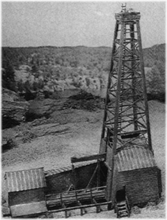
In the early days of energy exploration, the only way of locating underground oil and natural gas deposits was to search for visible evidence of these underground formations. In the mid-1800's Americans began drilling the first oil wells in areas where petroleum had seeped to the surface and pooled, indicating that more oil lay below the surface. However, because such a low proportion of oil and natural gas deposits actually seep to the surface, this made for a very inefficient and difficult exploration process.
As demand for oil and natural gas energy increased, so did the necessity for more accurate methods of locating deposits. Today, much more sophisticated techniques are employed, such as seismic surveying and satellite imaging.
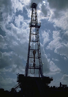
These new technologies have driven an incredible increase in the success rate of locating oil and natural gas reservoirs. However, the process of exploring for these reservoirs is still characterized by uncertainty, due to the complexity of searching for something that is often thousands of feet below ground. Ultimately, exploration companies must drill to determine whether oil or natural gas actually lies underground.
Looking at the Geology
Oil and natural gas exploration has to contend with the earth's surface, which has a complicated geological history. Geoscientists know that parts of the earth's crust, involving whole continents and oceans, move relative to one another. Over millions of years, as continents moved apart, areas that were once dry land subsided below the sea. The remains of microscopic plants and animals that lived in the seas were deposited in these areas.
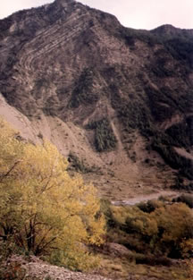
As continents collided, tremendous forces resulted in the formation of mountain chains, crumpling the rocks into folds and thrusting them over one another to form complex geologic structures. Some of these rock formations are known to be favorable to the collection of oil and natural gas.

One of the most common of these favorable formations is the anticline, where rocks have the form of a dome or arch. An oil or natural gas reservoir may be present in layers of a soft, permeable rock below an anticline, sealed in by a hard impermeable layer of rock. If a well is drilled through this impermeable layer, down to the reservoir, the oil and natural gas may be brought to the surface.
In addition to being found in a traditional reservoir, natural gas may also be found in less conventional formations.
Seismic Surveys
In this type of survey, sound waves are sent into the earth where they are reflected back by the different rock layers present. The time taken for sound waves to return to the surface reveals how deep the reflecting layers are. Seismic surveys also indicate what kinds of rock lies beneath the surface, since different types of rocks transmit sound at different rates.
In remote areas, sound waves may be produced by dynamite detonated several feet below the ground surface. In densely populated or environmentally sensitive areas where explosions are not practical, seismic vibrator trucks are used.

The most sophisticated seismic surveys are three dimensional, in which the seismic lines are laid out in a very dense grid, precisely located by the latest navigational techniques. Data is processed in advanced computers to provide very accurate, 3-D pictures of the formations and structures below the survey area. This process is very expensive - an offshore 3-D seismic survey can cost $30,000 or more per square mile, depending on the location and other conditions. Drilling a well, however, can cost millions of dollars. Thus, the time and money spent by oil and natural gas exploration companies on accurate geological surveys are good investments, since they help locate potential reservoirs accurately and minimize the necessity of drilling multiple exploration wells.
